The Madigan Line ended up on my bucket list after my first Simpson Desert trip with Gen. We had headed down the Hay River Track to Birdsville and then back across the French Line to Mount Dare. The Madigan Line crosses the Hay River Track and runs parallel to the French Line, so I had a glimpse but knew that I would return to explore this more remote and less travelled route someday.
Someday came, and I was itching to return to the desert. We’d just launched our new Trip Planner app, which was far too much computer time for my liking, and it seemed an excellent excuse to put the concept to the test.
I had a short window of time at late notice, which meant I only had a couple of weeks to get organised and would be travelling alone. I’d settled on the Madigan Line, but rather than the Nullarbor or Great Central Road, I decided on the Anne Beadell Highway to get across the country from Perth. The Anne Beadell Highway is an incredible 1,300km single track through the Great Victoria Desert.
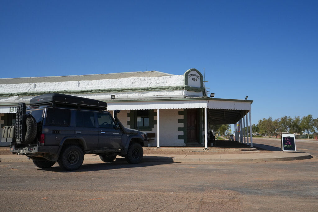
I finished the Anne Beadell Highway in Coober Pedy and enjoyed a break on the smooth Stuart Highway as I headed north to Kulgera Roadhouse. Then, back on the dirt, I headed east again en route to the Madigan Line. I stopped at Aputula (Finke) community for the last diesel before Birdsville. Then I continued along the Finke Road towards Andado Station just north of Mount Dare and Dalhousie Springs if you’re familiar with the area.

Finke Road, from this point, was still wide enough for two vehicles but deteriorated and was brutally rough with razor shape loose stones jabbing at the tyres and peppering the unbody. My tyres held, but a particularly loud whack lit up my dashboard warning lights like a Christmas tree and killed the speedo and tacho.
I parked up under the shade of a river gum to investigate. Nothing was evident to my eye, and my OBD scan tool indicated it was the vehicle speed sensor, so I decided to carry on. Unfortunately, I didn’t get far. While the river gum was shady, the river bed was soft sand, and I quickly got bogged. Luckily dragging the lever into low range and twisting the knob to engage the diff lockers was all the manual effort required for the recovery – it was bloody hot, and I wasn’t in the mood for a pysical recovery!
While rationally, I knew my LandCruiser was ok; doubts crept into my mind about the wisdom of my plans to travel solo in such a remote area.

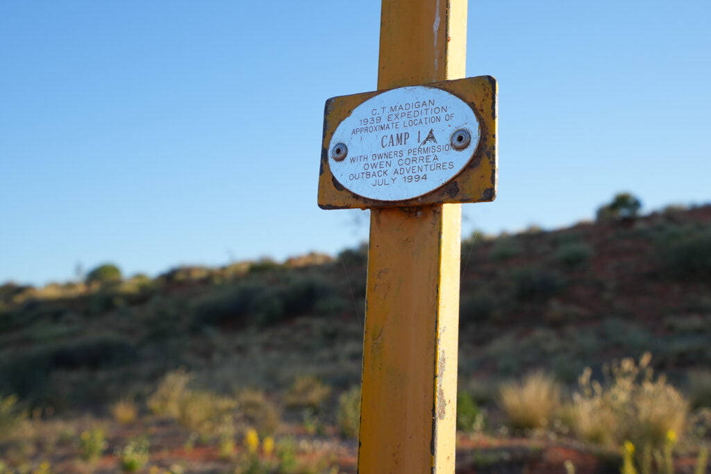
From Old Andado, the start of the trip is close. It was great driving up the Old Andado Track before I headed east and up to Madigan Camp 1A.

At this point, my electrical issue was still on my mind. My LandCruiser workshop book shed little light. Running my business and getting away are often at odds, so I bought a Starlink for this trip. After a quick Google search, I found a couple of possible locations for the sensor. The culprit was above the rear diff, and a stone had smashed the connection clip.
The connectors were still sound and slid together firmly, and a few tape wraps did the job. I was cautiously hopeful as I cleared the errors and started it up to test. It worked! It boosted confidence, and I was pleased to have the odometer back in action to see how far I’d travelled on the tank fuel.

I was excited to be on the Madigan Line and winding towards Camp 5; the landscape was transitioning from station country to wide open desert.
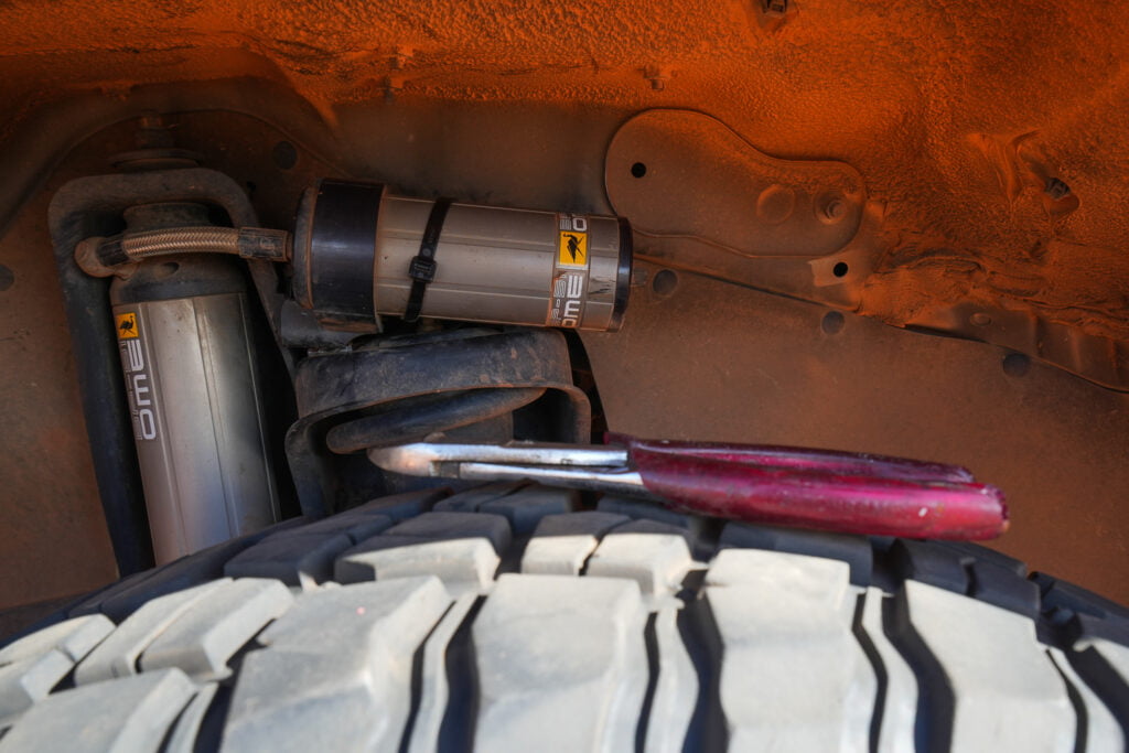
I tried to do quick walks around the vehicle on my breaks to spot issues and spotted my shock absorber’s remote reservoir swinging in the breeze. Luckily it was unscathed, and some cable tie engineering (my speciality) held fast for the trip. Again, a super minor issue, but an excellent reminder to take it easy in this remote area.
At this point, it’s worth mentioning my thoughts on risk. What could happen? Am I prepared for that? With satellite comms via my Starlink and GME PLB, plus plenty of food and water – for most scenarios, I figure I’ll be ok and hope to avoid an expensive recovery. Fire I worry most about. I watch for spinifex build-up and can do manual DPF burns in my LandCruiser if needed. I also carry two large DCP fire extinguishers plus, for these types of trips, I pack a grab bag with the PLB, water and some other goodies to keep me safe if my Cruiser lit up in flames.
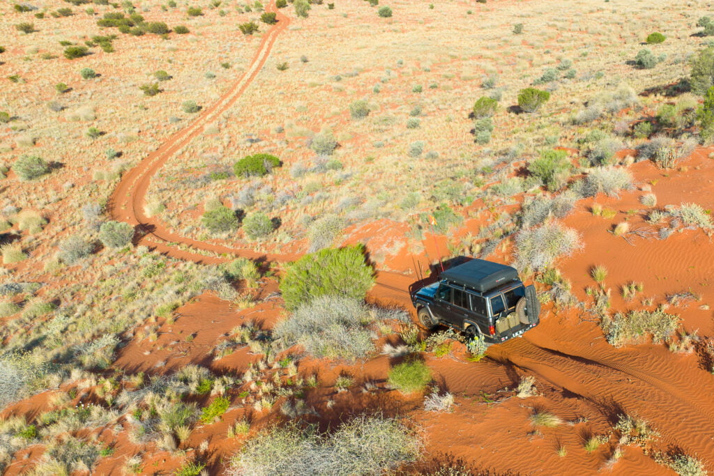
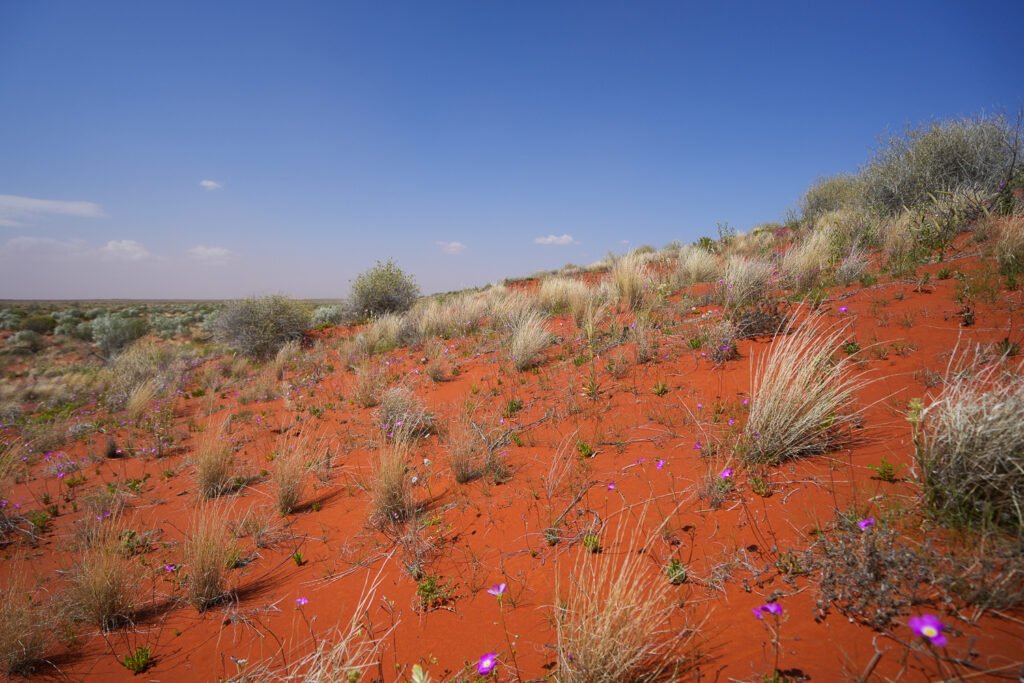
From Camp 5, the Madigan Line points east. Ahead, over 1,000 parallel dunes run north to south in remarkable formation. Poised on the top of the giant dunes, you can look out across the desert. The dunes are like a massive ocean swell perfectly frozen in time.

In recent years the track has been restricted for travel only from west to east. It’s a similar initiative on popular hiking trails like the Overland Track. I love that even if people are a bit ahead or behind, you won’t know it, and it feels like you have the entire desert to yourself. Also, with so many dune crests, it’s safer not to worry about who travels from the other direction.

The dunes of the Madigan Line make for incredible driving. The winds had blown the tracks from the crest of most dunes, which made me feel like I was cutting fresh tracks and adding to the fun. Dune after dune, I’d climb, divide and then make the steep descent on the eastern side formed by the prevailing westerlies.

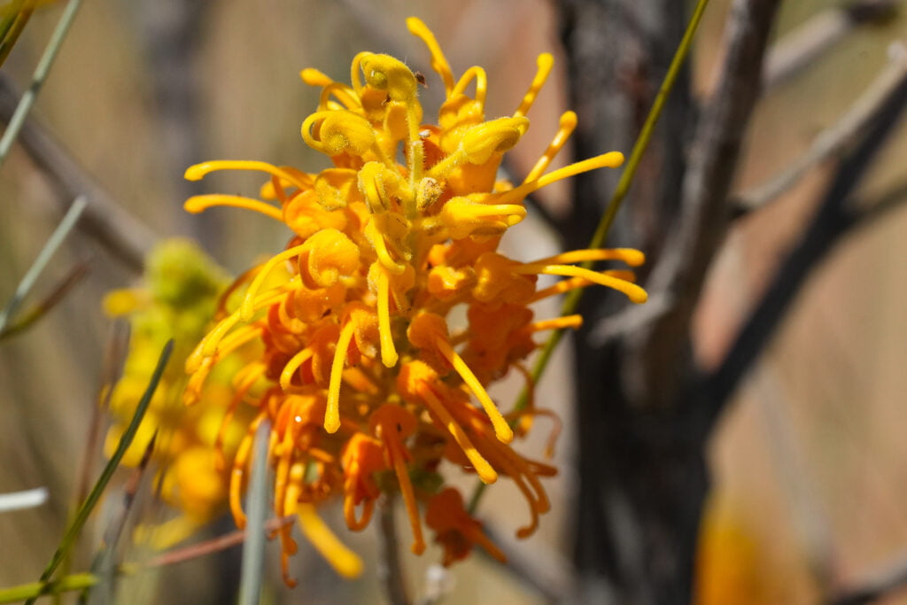
The Simpson Desert had received solid rain and was green and alive with wildflowers, birds and wildlife. It was as pristine and healthy as I’d seen.


While I always prefer travelling with Gen and my mates, it was great to spend time alone in a landscape like this; that is like a scale that makes it easier to measure what’s important in life.

While I travelled much of the track alone, I crossed paths a few times with a bunch of mates on their annual adventure moto trip. Swapping stories and seeing these guys having a great time in the desert was incredible.
In the air-conditioned comfort of my LandCruiser, it’s almost easy to forget that along the Madigan Line, you follow Cecil Madigan’s footsteps. The beauty, though, is that this place has changed little with time.

In 1939 at age 50, South Australian Cecil Madigan led a scientific expedition across the Simpson Desert from Andado Station in the Northern Territory to Birdsville in Queensland. His journey took 25 days with a party of nine, including a biologist, botanist, geologist, photographer, radio operator, cook and cameleers to wrangle the camels. Madigan named the Simpson Desert after the Adelaide businessman and President of the Royal Geographical Society Horace Simpson.

Closer to Birdsville, I crossed the Hay River Track, which brought back great memories of my trip with Gen – we loved it. Next, and all too soon, I was through the Munga-Thirri National Park and on to Adria Downs station.
Traversing this last section had me nervous. The rain had eased, but the long flat salt lakes and clay plans were still wet. In most places, I could find firm chicken lines and weaved my way through. On some of the longer runs, I used speed as a backup. Mostly it was fine, but I broke the crust a few times in a mud-spraying vehicle sliding close shave.
My friend Ian had loaned me an auger-style ground anchor just in case. There was nothing to winch off here, and travelling solo; was a comfort. But luckily, the anchor, my winch controller and MAXTRAX all stayed stowed in the vehicle.
Just when I thought I was through the thick of it, I dropped into a mandatory water-filled groove far more profound than it looked – over the bonnet deep. The mud water sprayed over the windscreen and roof, and as I fumbled for the wipers, I was driving blind and keeping the throttle down to avoid getting stuck for what seemed like an eternity.

I was unscathed by the mud bath and emerged to follow the QAA back over Big Red (dune) to Birdsville. The Madigan Line was an incredible trip, and I can’t wait for my next opportunity to spend time in the desert.
Madigan Line Permits, Permissions & Fuel
An entry permit from the Central Land Council is required. While there was no permit check for me, and there is a chance there won’t be for you, this is the simplest way of showing respect for people and country that may keep tracks open and pave the way for new routes.
I required permission to travel through Adria Downs station from Camp 19 to the Annandale Ruins and Camp 22. Adria Downs is a NASAA accredited organic cattle farm, so it prefers small groups and environmentally sensible travellers.
From Finke to Birdsville, I used ~134L of diesel. I’m always cautious heading into the desert and had the 180L main tank plus 40L in jerrycans, so I had plenty to spare.
Adventure Curated App
We made our app with trips like this in mind. So with my LandCruiser already in trip condition and all of my gear and favourite meals listed in the app, it was easy to make gear and food packing lists.
To minimise the chance of vehicle damage, I packed extra light for this trip. With my LandCruiser’s empty weight and upgraded GVM saved in the app, I could see my total weights and remaining payload and easily pack below the GVM limit. The weight feature accounts for the weight of travellers, gear, food, fuel, water and the vehicle itself.
In the Itinerary feature, I mapped out my rough days and distances and uploaded the permits and permissions next to the days I would need them.
You can learn more about the app here and we offer a free 14-day trial if you're interested in testing it out to see if it is helpful for your own planning.